skip to main |
skip to sidebar
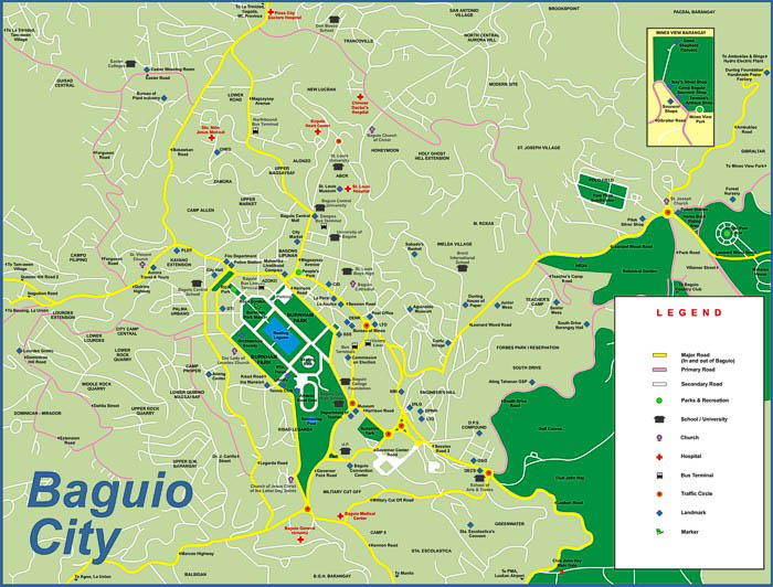
Baguio City Road Map 1
Here's one that contains ia lot of information, including icons that indicate buildings, mostly government, medical & educational institutions. Some street names are not very easy to find, in my opinion because, they are just indicated by arrows pointing to the roads.

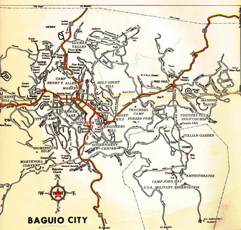
Baguio City Road Map 2
An older map, this one I like because it shows the major tourist attractions, points of interest and residential areas of the Summer Capital of the Philippines and is not cluttered by too much information so major street names are easy to find.

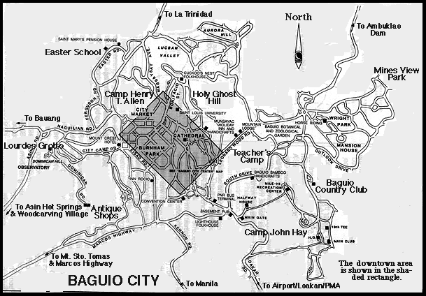
Baguio City Road Map 3
This one is very useful because it contains as shaded rectangle that shows the Central Business District area subject to the Number Coding Scheme. Like the one above it show the names of major roads.

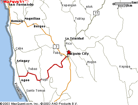
Baguio City Area Map
This one shows the location of the City of Pines in relation to the Benguet and La Union provinces in the Philippines. The red lines indicate access roads to the Summer Capital (e.g. Naguilian Road, Marcos Highway & Kennon Road partially.